Conference of the Research Project „Media Geography“
20-21 January 2011
Am Eichenhang 50, D-57076 Siegen, Germany
This conference aims to bring together proposals, critique and implementations of the topics of Neocartography and Neogeography which have recently emerged and are currently being actively debated.
Despite differing viewpoints on the definition of these almost synonymously used terms, most researchers would agree that the common keywords include the Geoweb, map mashups, volunteered geographical information, open source maps, geotagged data and media assist navigational practices. However, not all observers of cultural and geographical science and technology are comfortable with such a vague label for this phenomenon.
Neocartography claims to be the cartography of the everyday person using Web 2.0 techniques to create and overlay their own locational information on media platforms such as Google Earth and Google Maps. Rather than making claims on scientific standards, methodologies of Neocartography tend towards the intuitive, expressive and personal, but may just be idiosyncratic applications of traditional mapping techniques. However, does this also mean that these practices are of no use to the cartographic/geographic sciences? Or can we say that the numerous distributed geotagging platforms and applications like Flickr and Google Latitude have given rise to a new genre of “Maps 2.0” (Jeremy Crampton)? Will Google Maps and Google Earth become the basic layer for any kind of information we are looking for, and may thus maps and satellite imagery become a dominant way of interacting with networks as claimed by apologists of the Geoweb?
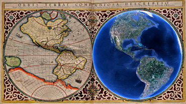
The increasing quality and clarity of visualizations of the Earth can be seen to be the common attribute shared by the rise of mobile communities using ubiquitous geolocation methodologies, on the one hand, and the rise of less-mobile geocommunities who are sharing mapped information and taking layered visualization to new heights. Neocartography represents a new way of doing/practicing geography by the public from a technical perspective, but how does Neocartography represent progress or innovation conceptually?
According to David Haden’s methodical attempt to unravel the vagueness in the modern usage of the term, at every major juncture of conceptual or technical geographical breakthrough, the term Neogeography has been invoked. More than that, many mapping practices now labeled as Neocartography are well represented in “pre-literate cartography” (Daniel Sui). As a consequence of that, should the Neogeography phenomena motivate the geospatial community to think more deeply and broadly about the true meaning of geography? To answer this, a historical perspective of the conference papers may be helpful in putting Neogeography and Neocartography into proper context.
It was and is always the case that the graticule does not impart specific geographical information; instead, it acts as a sign system that organizes geographical knowledge into visual schemes which depend on culturally accepted misrepresentation of abstracted territory. Thus, how does the format of the map shape media and their contents? Have digital technologies reconfigured the experience of mapping into navigational platforms? What is Neocartography? What examples are there of dedicated next generation mapping interfaces, and how do these examples integrate geographic data with non-cartographic interfaces and dynamic data with a static grid? Representatives of all disciplines currently subject to questions of digital cartography will debate the advantages and disadvantages of the ‘new’ cartographic paradigm at this conference.